Conservation-first coastal intelligence

Protect living shorelines with field data that moves people to act.

Frontline Conservation partners with nonprofits, restoration teams, and public-interest coastal programs to monitor habitat health, document risk, and guide on-the-ground protection without adding disturbance.

  • Thermal + multispectral Night-ready habitat visibility
  • Non-invasive surveys Fewer boots on fragile terrain
  • Rapid coastal coverage From nesting zones to erosion fronts
Drone scanning a protected coastline at sunrise
Wildlife protection Sea turtle monitoring
Habitat stewardship Dune and beach mouse habitat tracking
Coastal resilience Seagrass and shoreline erosion mapping
Operating posture 
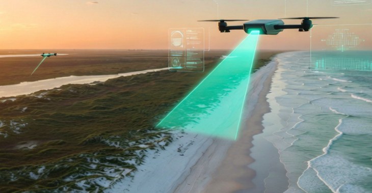
Low-disturbance aerial intelligence

Why organizations choose us

Conservation-first data for real coastal decisions.

Every flight is planned to reduce disturbance, expand coverage, and produce evidence that teams can actually use. We help conservation organizations move from scattered observations to consistent monitoring that strengthens protection, restoration, and long-term coastal resilience.

What partners receive

  • Repeatable surveys across beaches, dunes, seagrass beds, and shorelines
  • Thermal and multispectral imagery translated into usable field insight
  • Visual reporting that makes change easier to explain and fund
  • Monitoring plans sized for nonprofit teams and public-interest programs

Core programs

Monitoring services for vulnerable coastlines.

We support conservation groups, wildlife initiatives, and coastal resilience organizations with monitoring programs that help teams protect species, restore habitat, and respond to shoreline change.

Thermal imaging

Sea Turtle Nest and Hatchling Protection

Locate nesting activity at night, monitor hatch success, and identify emerging disturbance risks without crowding the beach.

  • Low-disturbance night operations
  • Nest location and movement visibility
  • Before/after evidence for seasonal protection plans

Habitat integrity

Dune Ecology and Beach Mouse Tracking

Pair dune-condition mapping with wildlife observation so habitat protection and erosion response can be planned together.

  • Burrow and movement zone awareness
  • Dune stress patterns mapped over time
  • Field-friendly reporting for recovery teams

Coastal resilience

Seagrass Health and Restoration Monitoring

Track submerged habitat condition with multispectral surveys that make restoration progress and coverage gaps easier to see.

  • High-resolution seagrass bed visibility
  • Before/after restoration comparisons
  • Decision support for funders and stakeholders

Shoreline change

Erosion Mapping and Coastal Risk Response

Measure shoreline movement, identify loss hot spots, and create clearer visual evidence for rapid resilience planning.

  • Centimeter-aware change detection
  • Trend visibility across repeat flights
  • Maps that support action instead of sitting in a folder

How engagement works

From Monitoring to Meaningful Action

01

Scope the coastline

Define the habitat, risk zone, and reporting goal so flights are aligned to real stewardship questions from the start.

02

Capture without disruption

Deploy thermal and multispectral surveys designed to reduce field impact while expanding visibility across hard-to-reach areas.

03

Translate imagery into action

Turn raw aerial data into maps, summaries, and visuals that can be used by program leads, funders, and agency partners.

Who we serve

Nonprofits, land trusts, coastal programs, and restoration teams.

Frontline Conservation is built for mission-driven organizations that need reliable field data without adding pressure to already fragile places. Our work supports wildlife protection, habitat restoration, shoreline resilience, and the people responsible for turning information into action.

Grant-ready storytelling Visual evidence that helps justify funding and next-phase work.
Board-friendly clarity Complex monitoring translated into language non-technical stakeholders can use.
Agency-aligned outputs Structured reporting built for compliance and collaborative decisions.

Start the conversation

Request a program review today.

Share a few details and we will follow up with the right next step for your site, season, and monitoring goals.

We work with public agencies, nonprofit teams, and mission-aligned operators managing habitat protection, restoration, and shoreline risk.

Entity